Subscribe to:
Post Comments (Atom)
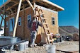
Life off the grid in the SW Texas desert. An experiment in sustainable living. NUMBERS AT THE END OF EACH BLOG POST: temp at 8PM,high temp,low temp,rainfall,wind conditions(CalmBreezyWindyGusty). YouTube Channel https://www.youtube.com/c/TheFieldLab Daily live streams at https://www.youtube.com/thefieldlab/live
Visit Counter
Subscribe to my YouTube channel
Good/Cheap hotel In Alpine
Blog Archive
-
▼
2017
(365)
-
▼
August
(31)
- on closer inspection...
- the north 40...
- making a mark...
- a monday matinee...
- be that as you may...
- lollypop...
- a friday night film
- firmware upgrade
- alfalfa inspectors...
- storm dodging...
- a monday matinee...
- when I consider thy heavens...
- truck battery
- a friday night film
- a wider berth...
- Holy Road
- 9 years of blogging...
- a monday matinee...
- I don't think so....
- 40 years...
- a friday night film
- NO BORDER WALL?
- 14 CFR § 107.61
- end of an era...
- a monday matinee...
- communication
- reset...
- a friday night film
- STOP
- the dreaded update
- accessories...
-
▼
August
(31)
About Me
- John Wells
- The Southwest Texas Alternative Energy and Sustainable Living Field Laboratory
Longhorn Benita's Fan Box
Longhorn Benita on Facebook
26 comments:
A little cinematic flight maneuver practice with the Mavic Pro - an ascent with a slow pan and camera tilts at the end. Connected to 18 satellites for this flight - the drone is amazingly stable. Funny thing is...it looks just like the view from Google Earth. News Theme by Kevin MacLeod is licensed under a Creative Commons Attribution license (https://creativecommons.org/licenses/...) Artist: http://incompetech.com Houston Vibes Score by Unicorn Heads used by permission from the YouTube Audio Library.
Extremely cool ... really enjoyed the view.
pretty good! what is the communication link between ground and drone.. you probably also said this and I missed it...
DJI uses a proprietary video transmission link called OcuSync. The DJI Mavic Pro using OcuSync starts by scanning for any local interference and then makes a decision between three transmission channels: 20MHz mode, the 10MHz mode, and the lowest priority 1.4MHz mode. During flight it will then automatically switch between channels (within the chosen mode) if it notices any interference. The transmission distance is good up to 4.3 miles.
Very enjoyable. Thanks!
Wow. I missed the exciting "go to the movies music". That was good. TY.
Except for the roads, that could be the surface of Mars. I agree, the picture is amazingly stable. Does the camera have shake reduction capability? I didn't see you in the video- where were you?
The Mavic Pro camera has a 3 axis gimbal that keeps it stable. I am there...somewhere.
What is the max altitude?
WhyR I think I found him . https://1drv.ms/i/s!AgDkM0Iv4V-siMw3gVGiFu0SePTo3w
Lets try that link again here
good spot MMMike.
…am guessing ~1,500 ft of altitude?… don't use GEarth much, but am impressed it even renders Ben's horn shadow…
GE views and the STOP before its latest demise (image date: 3/13)
seems counterintuitive that you have to do this to see so far… but you will see them coming from way off…
VR headset
interesting news: " The U.S. Army has ordered its members to stop using drones made by Chinese manufacturer SZ DJI Technology Co Ltd because of "cyber vulnerabilities" in the products." goo.gl/Q1qTCr
not sure what that is all about .. but ironic that our own armed services are using drones made in China .... in the first place... we don't have drones of equal capabilities made in the USA?
which then got me to thinking... if our Country's Founding Fathers ever envisioned drone technology when they drew up the "rights" that we have... and whether or not ..at some point.. laws might be written that will essentially make it illegal to operate them over property that one does not own.. i.e. only over your own property ... unless "approved"... interesting issues... but I digress... John's video is compelling in the perspective he presents and it conjures up all kinds of future potentials once he gets airborne.."looks around" and then might fly down to a particular point with a story to tell.. like the drinking bucket.. but there are many other possibilities from Ben to the roaming Donkeys to Chupa... even to the UPS truck coming off 118 on it's way to John... but I digress.. big time..and then some !!! ;-)
Gorgeous!
I've pored over that whole area via Google Earth many times to see where I've been in person, up and down both sides of 118 and way out onto the ranch and back, then up the river to 67 and up to Marfa, and over through Alpine to Marathon and back down 385, but this is simply the most gorgeous telling I've seen.
The slow beautiful spiral of ascension and panning over vast desert landscape. . .gorgeous.
Beautiful, thanks for sharing. What was the maximum altitude reached on this flight? Max.
Wow. Simply wow. It is harder to see the natural beauty of the land from the ground or static images. This is awesome.
John - not really into conspiracy theories but drones are going to push the envelope in all manner of things.. we have not fully considered yet... and especially so as they get more capable of flying longer, faster, at night, loiter/sleep then come awake per program or sensor e.g a sile security monitor than can then "follow" an intruder/bad guy who broke in .... flying autonomously or per a programmed mission...on and on and on... hundreds, thousands of potential uses... some of which will be considered a threat to others... i.e. can your drone "carry" your weapon like you can in your cars glovebox.. and bring it to you somewhere? can you "hunt" with it? etc, etc..
we're just scratching the surface of what they can be used for.. and you are as they say "an early adopter"!!! ;-)
Larry G: Interesting story about the military and DJI drones. It kind of makes sense though since the drone stores telemetry and image data from every flight - although the data stays on-board and is not transmitted to some clandestine site. DJI has responded by stating that the data is not shared with any government agency and is only used to assess system problems and flight failures when a drone is sent in for repair.
Here is a thought that would make for a good Sci-Fi movie. According to a report issued by the FAA - Annual drone sales are expected to grow from 2.5 million in 2016 to 7 million by 2020. Are they a trojan horse ready to conquer America? Is China going to push a button some day and turn all our drones against us? My guess is no... but you can expect to see this scenario begin to play out on conspiracy websites soon.
ISIS might spoil the hobby for everyone... https://www.washingtonpost.com/news/checkpoint/wp/2017/06/14/isis-drones-are-attacking-u-s-troops-and-disrupting-airstrikes-in-raqqa-officials-say/?utm_term=.3a6c8db62a14
One word.. INCREDIBLE!
It is amazing that a private citizen has the technical capability at hand to make such a visually stunning video.
I hope when every Tom, Dick & Harry are out there droning, it won’t turn around and bite us... it could turn out even worse than “Social Media” (lol)
someone is droning 'near' - Marfa near - you
already broke another Phantom - TX has hard air evidently… but good sunrises & sets
I noticed the areas of Ben's domain where he roams along with his sometimes guests is greener than the rest of the desert. I read an article about an area in Australia which was desolate, then they put herds of livestock there, a few years later the area was much greener.
Those "green patches" are just left over alfalfa.
Wow. This is what you do best, bubba! Keep it up. That was powerful.
What was the final altitude? Any way these modern marvels can have a compass built in...it would be great to know what directions it's shooting?
(How's the "widgy" working out - Bonita shirt still going strong!)
john b. wells
https://www.youtube.com/watch?time_continue=707&v=rvQ9DjJNal0
Post a Comment